Ardent Engineering service
Climate Action, GIS & Remote Sensing
Climate action, disaster-risk, GIS and remote-sensing services supporting evidence-based planning and climate-resilient development.

Ardent Engineering service
Climate action, disaster-risk, GIS and remote-sensing services supporting evidence-based planning and climate-resilient development.
Ardent Engineering & Consultant provides integrated climate action, disaster-risk management, GIS and remote-sensing services to support evidence-based planning and climate-resilient development. We combine geospatial technologies, satellite data, spatial analysis and climate expertise to help clients understand risks, manage resources and make informed decisions.
A Climate Action Plan identifies climate risks, emission sources and opportunities for mitigation and adaptation. It develops practical strategies for reducing greenhouse-gas emissions, improving climate resilience and promoting sustainable resource management while integrating climate considerations into development planning and infrastructure investment for long-term resilience.
Disaster Risk Reduction assesses hazards, vulnerabilities, exposure and potential disaster impacts, including risks from floods, cyclones, storm surges, landslides, droughts and other climate-related hazards. The service develops risk-reduction strategies, resilience measures and preparedness plans for safer communities, resilient infrastructure and informed emergency planning.
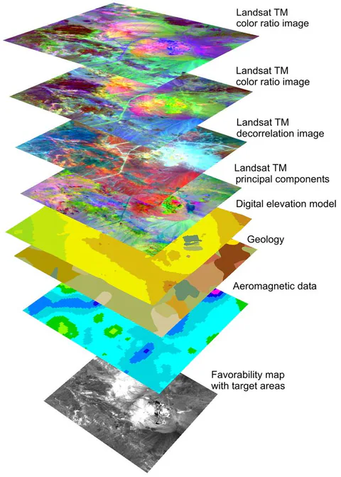
Precision Satellite and GIS Mapping uses high-resolution satellite imagery, GIS and remote-sensing technologies for accurate spatial analysis. Services include environmental and infrastructure mapping, hazard assessment, change detection, terrain analysis and spatial-database development, integrating multi-source geospatial data into maps and actionable insights for planning, monitoring, decisions and resource management.
Land Use and Land Cover mapping uses satellite imagery, remote sensing, GIS and field verification to identify built-up areas, agriculture, forests, wetlands, water bodies and other land-cover types. It supports land-use change detection and spatial-trend analysis for urban planning, environmental management, infrastructure development and climate-resilience planning.